
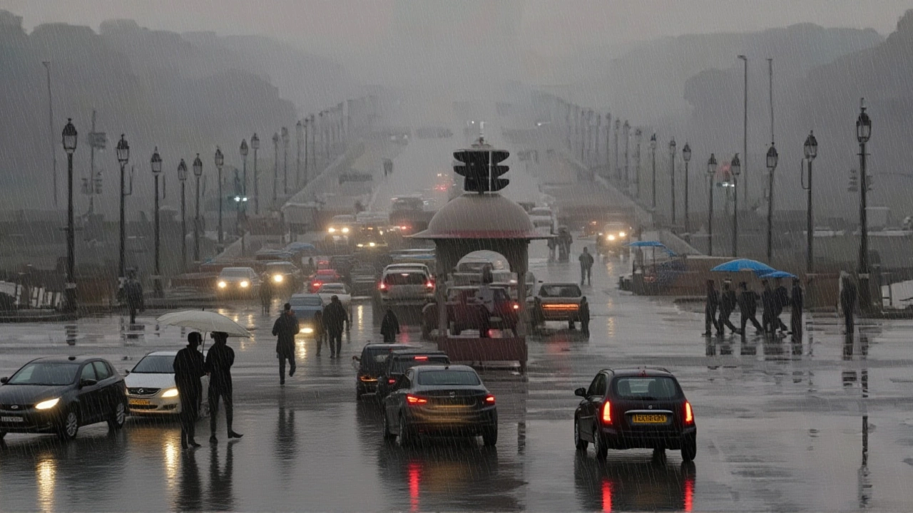
When Cyclone Montha made landfall between Machilipatnam and Kalingapatnam on the night of October 29, 2025, it didn’t just bring wind — it brought chaos. With sustained speeds of 100 to 110 km/h, the severe cyclonic storm uprooted hundreds of trees, collapsed rooftops, and stranded thousands along the Andhra Pradesh coast. By 5:30 p.m. IST on October 30, it had weakened into a depression centered over southern Chhattisgarh, but its aftermath is still unfolding across eight states. The real danger now isn’t the wind — it’s the rain. And it’s not stopping.
From Storm to Depression: A Rapid Weakening
What started as a powerful system with gusts near 130 km/h over the Bay of Bengal didn’t just fade — it transformed. According to India Meteorological Department (IMD) senior meteorologist Dr. M. Mahapatra, the cyclone lost 30% of its intensity within 12 hours of landfall. "It moved northwest at 18 km/h, then slowed to 10 km/h," he said. "Now it’s anchored over Chhattisgarh, but its moisture is spreading like ink in water." By 30 October, the storm’s core had shifted 50 km northeast of Machilipatnam and 90 km west-southwest of Kakinada. The IMD’s Navdeep Kumar confirmed the system had fully entered landmass by late afternoon, with its circulation now disorganized but still saturated with moisture. "It won’t vanish overnight," Kumar warned. "It’s becoming a depression, but that doesn’t mean safety — it means prolonged rainfall."
Eight States on Alert: Red, Orange, Yellow
The rain bands of Cyclone Montha didn’t stop at the coast. They stretched northward like fingers, soaking Telangana, Odisha, Bihar, Jharkhand, West Bengal, Maharashtra’s Vidarbha and Marathwada, and even parts of Gujarat’s Saurashtra-Kutch region.
IMD issued an Orange Alert for Bihar and Saurashtra-Kutch — meaning "extremely heavy rainfall likely." Yellow Alerts blanketed eastern Uttar Pradesh, eastern Madhya Pradesh, Jharkhand, and coastal Andhra Pradesh, where 100–200 mm of rain fell in 24 hours. In Telangana, some villages recorded over 250 mm — more than their average October rainfall.
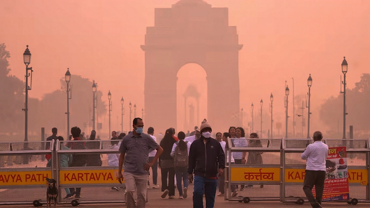
Even Delhi-NCR felt the chill. Temperatures dropped by 5°C in 48 hours as the cyclone’s outflow pushed cold, moist air inland. "It’s not just rain — it’s a weather system rewriting the seasonal script," said Dr. Aruna Rao, a climate analyst at the Indian Institute of Tropical Meteorology.
Rescue Operations in Overdrive
By the morning of October 30, Chief Minister Mohan Charan Majhi of Odisha announced that 11,396 people had been evacuated to 412 relief camps. The Odisha Disaster Rapid Action Force (ODRAF) deployed 30 teams, while the National Disaster Response Force (NDRF) sent five specialized units to Andhra Pradesh and Telangana.
Coastal districts like Srikakulam and Visakhapatnam saw power outages lasting over 20 hours. Fishing boats were grounded; 12,000 fishermen were ordered to stay ashore. Rail services between Vijayawada and Kakinada were suspended for 36 hours. Airports in Visakhapatnam and Tirupati canceled over 80 flights.
"We’ve seen cyclones before," said local resident Suresh Reddy, standing amid flooded lanes in Machilipatnam. "But this one came fast, and the rain kept coming long after the wind died. It felt like the sky was crying for days."
Why This Matters Beyond the Rain
What makes Cyclone Montha unusual isn’t just its strength — it’s its path. Most cyclones in the Bay of Bengal move west or northwest and dissipate over central India. But this one tracked deeper into Chhattisgarh, a region rarely hit by such systems. That’s a red flag for climate scientists.
"The Bay of Bengal is warming faster than the global average," said Dr. Priya Menon, a climate modeler at the Indian Institute of Science. "This means cyclones are gaining more energy, moving slower, and dumping more rain inland. We’re seeing a pattern — not an anomaly." The economic toll is already mounting. Over 18,000 hectares of standing crops in Telangana and Vidarbha were submerged. Rice and cotton fields, critical for India’s food security, are now waterlogged. In rural areas, roads turned to mud, cutting off access to medical centers and schools.
What Comes Next
IMD forecasts the depression will continue moving north-northwest over the next 12 hours, weakening further into a low-pressure area by November 1. But the rain won’t vanish with it. Moisture from the Bay will linger, triggering more showers across central and eastern India through the weekend.
Authorities are now shifting focus from rescue to recovery. The Ministry of Home Affairs has released ₹200 crore for immediate relief. The World Food Programme has offered logistics support. And farmers’ unions are demanding crop insurance payouts — fast.
Historical Context: A Pattern Emerging
It’s not the first time. In 2021, Cyclone Gulab dumped 300 mm of rain in Madhya Pradesh — unheard of for the region. In 2023, Cyclone Biparjoy caused unprecedented flooding in Saurashtra. And now, Montha. Each event is stronger, slower, and wetter than the last.
"We used to say, ‘Cyclones are coastal problems,’" said Dr. Rao. "Now we say, ‘Cyclones are national problems.’"
Frequently Asked Questions
How is Cyclone Montha different from previous cyclones in the Bay of Bengal?
Unlike most cyclones that weaken rapidly after landfall, Montha retained its moisture longer and tracked deeper inland — reaching Chhattisgarh, a region rarely affected. It also moved slower (10–18 km/h), allowing prolonged rainfall over multiple states. This pattern matches climate models predicting slower, wetter cyclones due to warmer sea surface temperatures in the Bay of Bengal.
Which areas are still at risk after the cyclone weakened?
Even as a depression, Montha’s remnants are causing heavy rain in Bihar, Saurashtra-Kutch, eastern Uttar Pradesh, Jharkhand, and parts of Madhya Pradesh. IMD warns of flash floods in low-lying areas, especially near rivers like the Godavari, Mahanadi, and Son. Rural roads and drainage systems are overwhelmed, increasing the risk of landslides in hilly zones.
Why was Odisha better prepared than other states?
Odisha has invested heavily in disaster resilience since the 1999 supercyclone. Its early warning system, community-based evacuation drills, and the ODRAF have saved thousands. In contrast, states like Bihar and Jharkhand lacked coordinated flood response plans. Odisha’s 11,396 evacuations were possible because of pre-emptive action — not last-minute panic.
What impact will this have on India’s food supply?
Over 18,000 hectares of rice and cotton crops in Telangana and Vidarbha are submerged, threatening harvests for the next quarter. These regions supply nearly 15% of India’s cotton and 8% of its rice. Delays in replanting could push up prices by 10–12% by early 2026, affecting inflation and rural incomes. The government may need to release buffer stocks earlier than planned.
Is climate change making cyclones like Montha more common?
Yes. The Bay of Bengal’s sea surface temperatures have risen by 0.8°C since 1990 — faster than the global average. Warmer water fuels stronger cyclones, while weaker upper-level winds allow them to linger. Studies from IITM show cyclones now spend 15–20% longer over land, increasing rainfall intensity. Montha is not an outlier — it’s the new normal.
What should people in affected areas do now?
Stay indoors if possible, avoid flooded roads, and monitor IMD alerts via official apps. Do not attempt to cross waterlogged bridges or rivers — currents can be deadly. Keep emergency supplies ready: water, medicine, flashlights, and power banks. If you live in a low-lying area, prepare to move to higher ground. Relief camps are operational in all affected districts.